Mount Abang
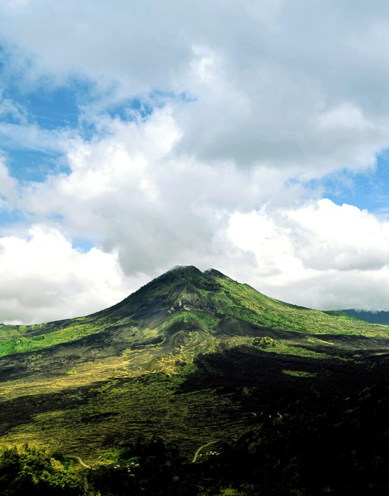
Photo: WhiteducksIG / Wikimedia Commons, CC BY-SA 4.0. No editorial changes by BaliFinder; WordPress may generate display sizes. Source photograph dated 2013-12-11.

Photo credits
1.
Photo: WhiteducksIG / Wikimedia Commons, CC BY-SA 4.0. No editorial changes by BaliFinder; WordPress may generate display sizes. Source photograph dated 2013-12-11.
Questions about this place?
Ask about access, facilities or your visit in BaliFinder chat.
Chat with BaliFinderAbout this destination
Mount Abang is a mountain destination in Kintamani for travellers who want a hiking-focused experience within the wider Batur landscape. Indonesia’s tourism authority identifies it as Bali’s third-highest mountain, at roughly 2,150 metres, with views toward Lake Batur and Mount Batur when conditions allow. Plan the climb according to the actual route and your group’s fitness rather than assuming it is easy because it appears in a short sightseeing itinerary.
A different mountain experience
Abang should not be confused with Mount Batur. They offer different routes and perspectives on the region, and booking a guide for one does not establish access to the other. Ask your operator to name the trailhead and describe the return route clearly so that transport and walking plans match.
A mountain’s elevation alone does not tell you how much climbing a particular trail requires. Ask about total ascent, path condition, steep sections and the expected time for both directions. Published estimates are useful only as a rough introduction; wet ground, pace and stops can change the day considerably.
Arrange local guidance and access
Use a knowledgeable local guide if you are unfamiliar with the route. Confirm current permission, closures and any religious restrictions before travelling. A guide should explain where visitors may go and how to behave around sacred spaces, as well as lead the walking route.
The tourism authority notes a temple at the summit. Treat this as a place of worship, not as a shelter or photography platform available for unrestricted use. Ask what clothing or conduct is expected and leave offerings, structures and religious objects undisturbed. Do not enter a closed area simply because it lies near the highest point.
Sunrise or daylight?
A sunrise itinerary requires walking before dawn and a careful assessment of lighting and navigation. Confirm who supplies headlamps and check them before leaving. An early start also means planning rest and transport the previous day, particularly if your accommodation is far from Kintamani.
A daylight outing may make the approach easier to observe, but weather still determines visibility. Discuss the best start time with the guide for the conditions and route. No schedule guarantees a clear lake panorama, and turning around when conditions deteriorate is a sensible part of mountain planning.
Prepare for the whole hike
Wear sturdy footwear with traction and carry rain protection, layers, drinking water and food. Keep your bag manageable so that you can move comfortably on uneven ground. Tell the guide about relevant limitations and agree on a turnaround plan before starting rather than waiting until the group is separated.
Allow energy and time for the descent. Tired legs and slippery surfaces can make the return more demanding than expected. Keep space between walkers on narrow sections, avoid shortcuts and carry all rubbish back out. If camping is proposed, confirm that it is currently permitted and that the organiser provides suitable equipment and waste arrangements.
A quieter plan for companions
Not everyone in a group needs to join a mountain climb. Lake Batur, Penelokan and Batur Geopark Museum can provide an alternative day for companions who prefer scenery and interpretation. Arrange separate transport carefully rather than assuming a driver can move repeatedly between distant trailheads and viewpoints on a tight schedule.
Is Mount Abang the same as Mount Batur?
No. Confirm the mountain and trailhead when booking, since they are separate hikes.
Can I rely on a fixed two- or three-hour ascent?
No. Treat published durations as indicative only. Ask a local guide about current terrain and plan for your group’s pace, weather and return journey.
Sources: Indonesia Travel: Mount Abang’s location, elevation and summit setting.
Photo: WhiteducksIG / Wikimedia Commons, CC BY-SA 4.0. No editorial changes by BaliFinder; WordPress may generate display sizes. Source photograph dated 2013-12-11.